In their mission test, looking at different primary source letters from the 1840s, pieces of birch bark, and paintings depicting Ojibwe People by lakes and using birch bark canoes, students documented details they notices, connections they found between the materials and questions they had about the materials. They were ready to receive their next communication from Agent X.
The mysterious envelope arrived during the next class. Inside was a trifold card that had one of the earliest maps available of the Chicago and Great Lakes area, a picture of the City of Chicago today and a question mark. Students spent time discussing what the clues might mean and what connections it might have to the materials they studied in their Agent X test.


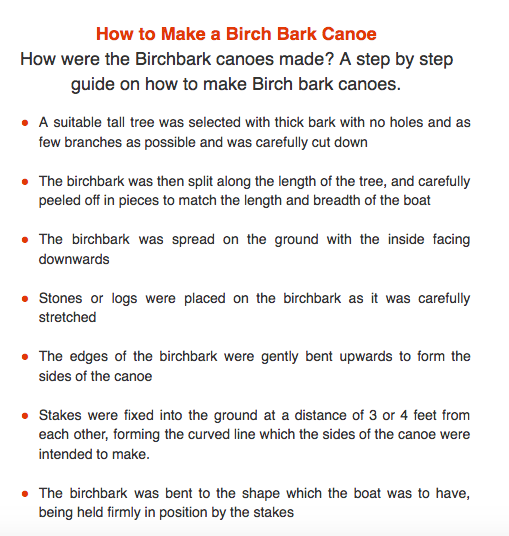
The second envelope included more materials and another letter from Agent X with details about their first mission and the information that they would be learning more about birch bark canoes, innovation and transportation. Students worked in small groups and examined the images of birch bark canoes, watched a video on the making of the canoes and information sheets about birch bark canoes and their role in the Ojibwe People’s lives. Students were also asked to make connections with what they were learning about Native American tribes that lived around the Great Lakes in their classrooms studies. Students documented information that they learned about birch bark canoes and the connections to innovation and transportation.


There was also a collections of maps in the resources. One of the maps was from the early 1800’s and one of today. Students spent time looking at the maps and thinking about why birch bark canoes and water transportation would have been so important. Students used the large touch screen computer we have in the library to add thoughts and ideas to a Google map of the Great Lakes area. This map is an ongoing part of the project. Students will be adding different layers of transportation to the map as they study different types of transportation. The map, hopefully, will be a great visual when students are asked to think about what they have learned from the past and how they might create a transportation system for the future.


Up next: The Design Challenge
No comments:
Post a Comment
Note: Only a member of this blog may post a comment.